So I spent a day riding the Speedfox around the Blue Mountains yesterday, and had a great time, though I covered fewer kilometres than originally planned.
Torrential rain during the week blew the original plan, which was to take two relative Newbies down the Oaks track. NPWS closures and a river purported to be in flood meant it was probably unwise to do much in the lower mountains, so I decided to head for higher ground in the Mt Victoria - Blackheath area, but not before stopping off in Lawson to have a one-hour thrash around the Old Volvo Trail.
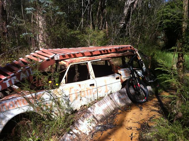
The old Volvo Track is a short but technical singletrail area at the edge of Lawson's business park, so named because, well, there's an old Volvo on it.

It links up with a few other short tracks, including Postie's Pass, but I stuck to the Volvo end of things. The ground was still quite wet and slippery, the fenceline was overgrown (and possibly snakey), and I had to re-align a lot of the boardwalks, but nevertheless this was a lot of fun, even for a small, scrappy and relatively anonymous patch of wasteground. The volvo loop itself is worth doing over and over just for the novelty value of riding over a car.
Part of the reason I sought the Volvo Track out was because I hadn't yet gauged how the new bike and I would handle properly technical riding, and I found a few things out. First, I'm still not fully used to the front wheel being so far from the bars, with 120mm of suspension travel, riser bars, spacers and a tall headtube, my riding position is vastly different to my old short-travel hardtail. This means my accuracy in tracking the front wheel could use a bit of work, and the aerial boardwarks (and see-saw) showed this up, most ignominiously when I overstepped the mark and popped off the side of one into the creek. Second, and related, my center of balance is biased too much towards the back of the bike, meaning sharp corners can see the front wheel losing contact completely. Not a good thing in slippery conditions. I'm also overly reliant on my front brake compared to what the bike needs. All these aspects will be worked on.
So, after that little thrash, I headed for the upper mountains, with no clear plan in mind. Filling up the car at Mount York, I checked the web and decided that Lockyer's Line of Road and Lawson's Long Alley might be a worthwhile loop, partly because I'm planning a two-day mostly off-road ride to cross the mountains and need a way onto the plateau proper from Lithgow. I'd figured it was either up from Hartley Vale (once known as Vale of Clwydd, a Welsh connection) or up from Six Foot Track and the Megalong Valley, though the most logical route there is restricted for MTBs.
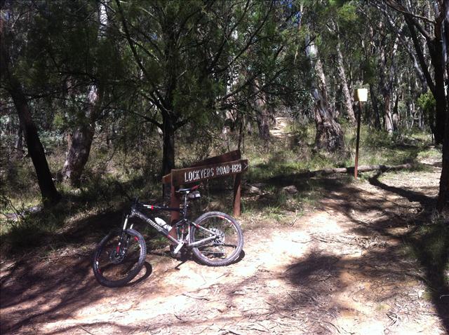
So, to the carpark at the head of Berghoffer's Road, Lockyer's Line of Road and Lawson's Long Alley, it was onto the bike and head across the line of hills to join the top of Lockyer's Track. Lockyer's is one of the original, early-1800s attempts to get from the plateau to the pastoral land beyond, but these days it's a well-known walking track and, apparently, a bridleway. The upper section is fast, bumpy singletrack until you reach a set of sandstone outcrops, at which point it becomes both technical and rocky, followed by steep steps which are only partially rideable, especially in wet conditions like today. I marvelled that this was ever considered a really viable route in the days of horse and cart, though clearly the modern-day walking track is much changed since the original pioneers pushed the routes through.
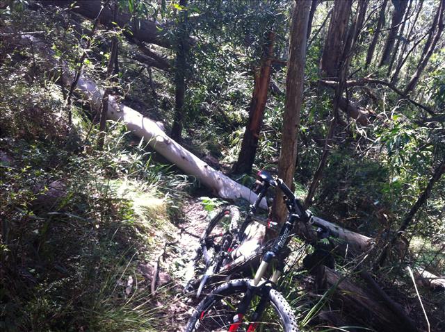
Shortly after the steps I found my way blocked by treefall, as you can see in the pic below, and had to fight my way through. I almost turned back, but fifteen minutes of hard work got me a squeeze through with the bike - no easy task - and access to the lower section, again fast singletrack with some jumps and tree branches.

At this point, I headed the wrong way, having forgotten which direction I was meant to be headed, and went south along Cox's Road, the original route down from the plateau, until I got the waterlogged lowland section, got my bearings and decided to turn back and find the Comet Inn.

Having found the road and hence the Comet, I took a break, and shortly after, joined the Lawson's Long Alley trail, another former stock route which follows a wide, private gravel road north towards the steep stuff. Again I got blocked by treefall, but this time it was passable without major incident, giving me access to the zig-zagging upward section, which is about 140m of climbing (out of ~200m overall) in roughly 2km of track - MapMyRide gave it a 7% climb thus rating UCI category 3 overall. It's steep, and with the damp conditions and plenty of fallen branches I certainly didn't ride it all, but it was mercifully shorter than I expected. Soon I was back on the plateau and at the car wondering what to do next.
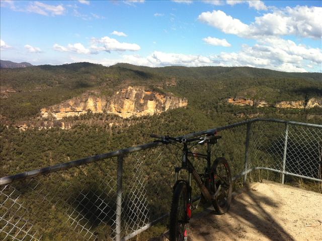
A quick look at the map suggested a quick 5km blast out to the Victoria Falls lookout might be fun, so I drove quickly to the Victoria Falls road junction and mounted up again. The track itself is graded, but full of corrugations from vehicle traffic, making it less pleasant than I'd hoped, and the views from the trail itself, aside from one short section, aren't spectacular, but there's a nice fast section (40km/h+) to the end, and the lookout over the Grose Valley is well worth a gander.

I decided since I was there I may as well walk down to the falls, so I rode partway down the singletrack until the steps got too steep, stowed the bike safely off the track and headed down.
This may not have been the greatest idea ever.
The track got slippier and slippier and I went downwards, not unexpectedly it's true, but in SPD cycling shoes I felt increasingly unstable. Still, on I went until, surprising myself, I realised just how far down into the valley I was heading. The descent is about 300m vertical into the Grose, and longer than I'd realised, and of course yet again I found myself stymied by treefall - this time with the falls themselves in clear earshot. Reluctantly, I turned around and began the long climb back up the valley side, recovering my bike at the top with calves burning, and heading, slightly more slowly than I'd originally hoped, back to the car. On the upside, I got to follow a Lyrebird for a good 500m of the upward climb, which was a nice nature encounter.
Overall, the day was a good one, though the last run was a tad disappointing, the treefalls were frequent and frustrating, and somewhere along the line I gashed my ankle and half-filled a shoe with blood. Still, I now have a confirmed option for climbing onto the plateau for my across-the-mountains ride, due to take place on the weekend of April Fools this year and cover something like 180km over two days.
Ratings:
- Volvo Track - do it. Do it often. ONE BILLION stars for sheer fun value. No scenery whatsoever, just technical fun riding. Totally accessible, and with a smorgasbord of riding options, and close to the road so when you crash off the top of the Volvo, the paramedics don't have a long walk to come and splint your legs.
- Lockyer's Track - nice downhill singletrack, be very careful for walkers, take great care at the steps and turn RIGHT at the bottom. Three and a bit stars. Don't ride up, because the steps will eat you
- Lawson's Long Alley - probably fun downhill, quite tiring uphill, but shorter than you might expect. Three stars
- Victoria Falls Road - horribly corrugated, the lookout is fantasic, but the trail itself is meh. Two stars
Update: Just in case anyone's interested, there's a Mountain Bike Trails page on this blog's companion wiki.