 |
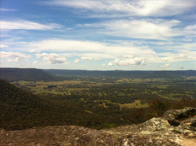
| The view from Hassan's Walls Lookout |
As I noted in the previous post, my plan for the weekend of 31st March - 1st April 2012 was to ride my bike across the Blue Mountains, from West to East.
Well, I did it, and it was a fantastic couple of days out.
Of course, things don't ever go to plan, and this ride was no exception. I realised on Saturday morning that I'd left my phone charger at the office, so was potentially leaving myself without an emergency contact method and without my GPS and speedometer. My office doesn't give me weekend access, so upon reaching Lithgow, I began a tedious hunt for a Micro-USB cable, or an iPod charger cable, to keep me wired. This delayed my departure by 45 minutes or so and frustrated the hell out of me, but eventually Harvey Norman came through with the goods, and I strapped on my helmet and gloves and bravely cranked towards my first trail of the day, Hassan's Walls Road. This is a winding 3-4km climb out of Lithgow to a spectacular view over Hartley before a similar length of loose, gravelly downhill firetrail to meet the Gap Road. Some parts of the descent were a bit hairy, but I got to the road unscathed.
Tarmac under the wheels, I hit the big gears and made my way into Hartley Vale at a record speed, and was soon rolling towards Fields Road and the Old Hartley Cemetery. This early 19th century bush cemetery - the earliest visible inscription is 1837 - served as burial ground for many of the early westward-pushing pioneers of the area, and was a fascinating, thoughtful stop-off. It's actually quite strange to be in a clearing in the middle of the Aussie bush, surrounded by ancient gravestones with names from history - including, I noted with surprise, the father of Henry Lawson, and a local clergyman who was drowned crossing a creek on his way home, and a surprising - shocking, even - number of infants in a cluster near the gate.
In pensive mood, I headed on to the Comet Inn, named, oddly, after a brand of kerosene once produced in the area, where I left the tarmac again and headed onto Lawson's Long Alley. I'd previously scoped out this trail and knew that after a few kilometres of undulations, I'd be facing a 2km steep climb onto the plateau, so I got on with it, and soon realised I was setting a fairly strong pace - even considering I had a low-speed crash on the way - hitting Mount York Road breathless but feeling strong. Quickly along Berghoffer's Pass and I was in Mount Victoria, and decided to grab some sushi at Mount Vic general store.
The friendly proprieter asked me how far I'd ridden as he served me a sushi bento, and once he ascertained my plan, called me "crazy man", laughed heartily and offered me a chair. I sat outside in the sun, grining as I nibbled surprisingly good sushi and drank freezing cold gatorade, and pondered the next section, mainly tarmac over Mount Boyce towards Blackheath. It seems possible to take some fire trails parallelling the road, but frankly it felt contrived to do so, so I kept the average speed up by using the Highway as far as Govett's Leap Road in Blackheath, where I broke off onto Wentworth Street and Valley View Road.
From here, I'd hoped I might be able to follow trails down to Lake Medlow, skirt the lake, find my way to Katoomba Airport and up Mini-Ha-Ha Road to Katoomba, but I was foiled by water catchment restrictions and again found myself on the Highway, and was soon in Katoomba, much less than four hours after leaving Lithgow. The distance, though I didn't run GPS due to low battery, was about 45-50kms, so I estimate that I averaged between 15 and 20 km/h, a respectable rate considering the climbs.
In Katoomba, I settled in for an evening of cider, pub food and cover bands, and retired blurred, incoherent and smiling.
I awoke the next morning at 7am, staring at a half-empty bottle of cider, to discover I'd drunk my breakfast budget, and somehow lost my towels. I covered my head with the blanket, rehydrated myself from my bike bottle and prepared to face the day. By nine I was in good enough shape to get moving.
 |
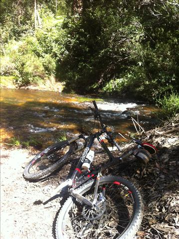
| Speedfox at Bedford Creek (Day 2) |
Back roads to Wentworth Falls were the opener for the day, and the kilometeres were eaten up quickly, bringing me ever closer to Anderson's Firetrail, the first off-road section of three. Anderson's is another trail I'd scoped out previously, so I was well-prepared for the fast, sweeping firetrail through the Blue Labyrinth, all 30-odd kilometres of it, and was happy to see birds of prey, lizards, snakes and spiders aplenty along the way. One minor scare on a downhill was completed without damage and soon I was cooking my brakes on the descent to Bedford Creek. Reaching the bank, I dripped some water onto my brake rotors and raised my eyebrows as it flashed into steam. It's a big hill.
And after two freezing cold, thigh-deep river crossings, it's a big hill back out. A BIG hill.
I tried as heroically as I could to stay on the bike, but frankly there are sections that just crush one's spirit. They make strong men weep like recently dumped teenagers. Still, I think I did a respectable job, and soon I was back on the tarmac in Woodford and heading for the top of The Oaks Firetrail. As ever, it was busy, and as I took a rest and a snack I was greeted by several groups of riders, all of whom nodded and raised eyebrows when, in response to the usual "heading up or down?" they were informed of how far I'd ridden up till then.
I was feeling pretty solid, but I knew from past experience that the bumpy downhill of the Oaks was likely to punish my calves, work my shoulders and make my feet ache, so I set off relatively calmly. Soon, though, I was riding past other groups of riders, either resting or repairing. The number of punctures was pretty high on this Sunday, but nobody seemed to be in real trouble. Shortly, though, a problem would appear for me.
A big downhill was ahead, and I was overtaken on the approach by another rider. Being, of course, an idiot, I wasn't about to let someone else breeze past me, and picked up my pace. Partway down, I felt something impact my foot, less painfully than I might have expected for a rock, but I kept my eyes on the trail and on the following uphill, pushed hard. As the angle eased off I looked down and realised my water bottle had made a daring escape. Clearly that was what hit my foot.
This wasn't good, because my three litre main water supply, a camelbak bladder in my backpack, had developed a leak from the bite valve, and had been losing water fast, mostly soaking my right leg and starting a fairly painful chafe. So I'm in the middle of a trail, at the tail end of the Australian Summer, in the middle of the day, with a hangover, and I'm running out of water.
Not good.
So I picked up the pace a little and tried to manage the leak as best I could, but I was starting to get a bit tired. Soon, though, The Oaks Helipad hove into view, heralding the beginning of the fast downhill, meaning I could relax a little, breathe a bit easier, and just worry about how much my feet and calves were aching from the impacts my suspension couldn't quite soak up.
Arriving at the gate, I figured I'd be OK to run the singletrack, so pressed on, soon splashing through the causeway and taking the big hill out to Glenbrook. As a matter of pride I made sure I rode the whole uphill from the causeway, marshalled my water a little more as far as Knapsack Park and figured I had enough to get me to Tench Reserve on the Nepean River, where I was scheduled to meet a group from Western Sydney Freethinkers, and might be able to cadge some water and maybe a beer.
But before that, I had to find my way through Knapsack Reserve, where I'd never been before. This I accomplished by dint of largely random direction finding and occasional half-hearted pokes at the GPS, and found myself on an extremely rocky steep descent necessitating occasional dismounts. This achieved, I hurtled down Mitchell's Pass, joined the Great Western Highway and reached Tench Reserve on the very dregs of my water supply.
80km done, and a BrewDog Hardcore IPA handed over for my troubles. Weather closed in, and we retired to the pub to wait it out. Several hours later, fed, watered and lightly cidered, I was ready and willing to seal the deal. Taking the train back felt like cheating, so I spun the bike as far as HappySinger's place, partook of a little vegan pasta and then got my head down for the last 50km of road, reaching Zombie-Proof Studios by way of the Great Western Highway and the Cooks River Cycleway after 10pm, rounding out the day at a bit over 130km of riding, two very sore legs, an empty camelbak and some very unwelcome saddle sores.
What a weekend.
It's now 24 hours later and I'm still in a little pain. Still, well worth it!
And, between you and me, I think I could do this in a day, if I arrive earlier at Lithgow, eschew the hangover and take Ingar instead of Anderson's Firetrail. It's closer to 180km, but I've done that kind of distance in a day before, back in the way distant past. Give me a couple of months to get my fitness together, give me a non-leaky camelbak, and watch this space.
posted @ Monday, April 2, 2012 11:44 PM